North Dakota Regional Water Systems
Map showing the boundaries and contact information for North Dakota's regional water systems. It was designed as a general education map with a finished size of 11"x17".
North Dakota Rural Water Systems
Map showing the boundaries and contact information for North Dakota's rural water systems. It was designed as a general education map with a finished size of 11"x17".
North Dakota Water Resource Map
The North Dakota Water Resource Map is a 22 x 34 inch poster/map updated in 2024. It highlights the geography of the state's waters and several water development efforts.
North Dakota Stream Flow Map
Basic map showing stream flow data in North Dakota. It was designed as a general education map with a finished size of 11"x17".
Major Drainage Regions Of North Dakota
Basic map showing major drainage regions (continental divides) in North Dakota. It was designed as a general education map with a finished size of 11"x17".
Major Drainage Sub-Regions Of North Dakota
Basic map showing major drainage sub-regions in North Dakota. It was designed as a general education map with a finished size of 11"x17".
Major Drainage Basins Of North Dakota
Basic map showing major drainage basins in North Dakota. It was designed as a general education map with a finished size of 11"x17".
Major Drainage Sub-Basins Of North Dakota
Basic map showing major drainage sub-basins in North Dakota. It was designed as a general education map with a finished size of 11"x17".
Major Watershed Basins Of North Dakota
Basic map showing major watershed basins in North Dakota. It was designed as a general education map with a finished size of 11"x17".
Devils Lake Watershed Basin Base Map
Portrayal of the Devils Lake Basin which shows HUC12 sub-watershed delineations along with commonly used administrative names for these sub-watersheds. Map size is 36"x36" and scale is 1:158,400 (1" represents 2.5 miles). July 2006
Northwest Area Water Supply (NAWS) Service Area
Map showing features of the Northwest Area Water Supply (NAWS) Project.
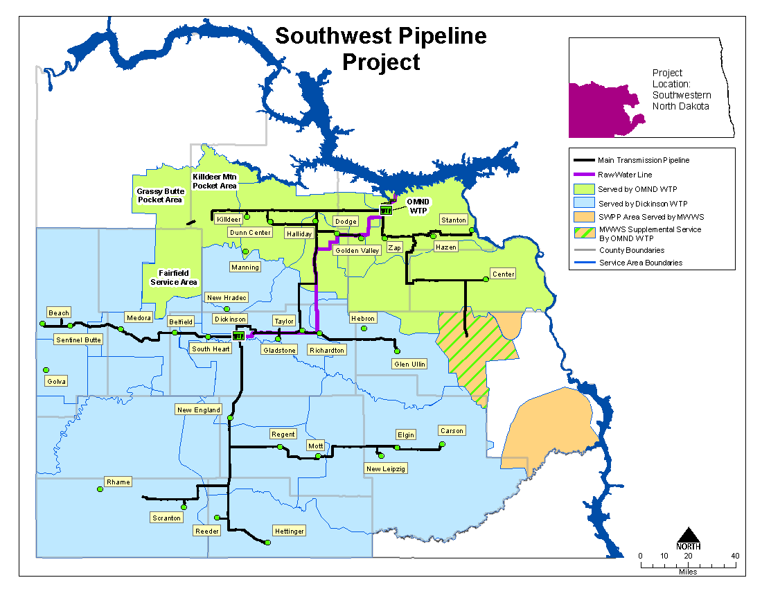
Southwest Pipeline Project (SWPP) Service Areas
Map showing features of the Southwest Pipeline Project (SWPP).


